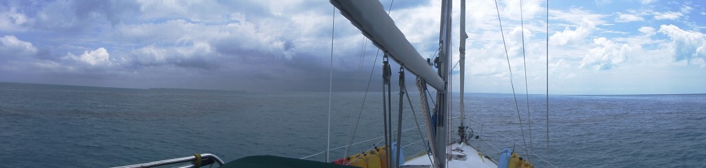
Weather Windows and Crossing the Gulf Stream

Getting to the Bahamas requires crossing the Gulf Stream. For most people, the task is either intimidating or completely routine. The difference comes from understanding conditions one’s likely to encounter in the stream. The stream can be a raging hell cat or a docile kitty. Since we crossed the gulf stream and seem to be getting around the Bahamas ok, we figured we should share some of what we have learned.

DSCF6575 - Version 2Conventional wisdom on crossing the stream is to get across as quickly as possible and avoid crossing when the winds have a Northerly component to them.  The idea here is that since the Gulf Stream (or more correctly Florida Current) flows towards the North, any wind from the North opposing the current creates a nasty, potentially boat eating, chop.

Before we crossed the Gulf Stream, Lisa and I did a bunch of research on how to find that magical weather window to get a smooth ride over. Unfortunately, we didn’t find much detail on the exactly how to pick a day. Fortunately, we have a great resource in Vanessa, a friend of ours in Key West. Vanessa pointed out a several things that we needed to factor in before making a decision — the most important being current.

Rule #1: Know the current and avoid opposing winds

Vanessa’s guidance was to avoid situations where the wind and current are opposed. This applies to the Gulf Stream as well as other areas like the North West Channel and Tongue of the Ocean in the Bahamas, and pretty much anywhere else like the West Coast of the US where you can find strongly opposed wind and current.

With crossing the Gulf Stream, this is a little trickier than just picking a south wind. The gulf stream has eddies that spin off periodically. If you catch one of these eddies, it’s entirely possible to have most of your ride be smooth and then get beaten up in the end when you hit an eddy with an opposing south wind.

Rule #2: Look for a wave interval in seconds that’s greater than 1.6x the wave height in feet.

What makes life uncomfortable isn’t wave height per se, but how steep they are. For example, three foot waves aren’t a problem. Three foot waves on a two second interval will make Pearl buck like a bronco. I was given this rule of thumb by a fisherman on the Oregon coast when I was contemplating crossing the Columbia Bar.

In general we look for a wave period that more than 2x the wave height and have been quite comfortable so far. The math is easier with 2x.

Rule #3: Use your OWN judgement

Regardless of what the weather gurus, services, and anyone else says, use you own judgement and interpret the data yourself. It’s your boat. It’s your life.

Everyone has a different comfort level. Chris, a good friend of ours, enjoys surfing his boat down large waves, a bottle of rum and cutlass in one hand, the wheel in his other, and a cigar stuck between his teeth. No offense to Chris, but he’s been sailing most of his life and has a very different skill and comfort level to Lisa and myself. That’s something he can do safely.

Chatting over drinks with various people, we’ve heard lots of tales of regret where someone decided to join a group of other boats and had a miserable time or a dangerous ride. Lisa and I prefer to use our own judgement even if it means we travel by ourselves. We take our time and pull back whenever we are not comfortable.

As a result, Lisa and I tend to pull data from a number of different sources before we make a GO / NO GO decision. What we like to see is a consensus between all the data sources. There appear to be at least two different weather models that services use that can offer quite different forecasts — hence our interest in consensus.

1. Hybrid Coordinate Ocean Model (HYCOM)

Hycom offiers insights into what gulf stream currents are doing — particularly eddies. If you would like to find out more about HyCOM, you can browse their website. What’s more interesting, however, are the forecast models for the speed and currents layers for the Florida Keys and the Gulf of Mexico that are found here.

There are two links to check out. One is an animated forecast for the speed and currents layer for the next 30 days. The animation gives you a good sense for what’s going on but it zips by pretty quickly. You can step through the individual images here. Make sure you read the information at the top of the page to figure out what to look at.

While this isn’t the most user friendly site, it does give you access to raw information that other sites synthesize.

2. BuoyWeather

We like Buoyweather for several reasons. The most important being that you can create virtual “buoys” along a route that you are planning save them as favorites, and either get automated daily emails or send an email to query their servers for that predefined location. You can also get passage forecasts that are optimized for low bandwidth connections. The site contains a lot of information, you just have to play with it for a bit to get it dialed in to suit your need. While you can get decent information off the free version of the site some of the most useful features require a subscription.

Note: for some reason, access to buoyweather in the Bahamas is quite slow.

3. AviationWeather

This is an aviation rather than sailing related website. It does, however, offer great insight into the “big picture,” where the highs, lows and fronts are and how they are moving. The key here is understanding what fronts are going over you. I like looking at the surface prognostication charts for this.

Typically in Florida and the Bahamas, as a front approaches the wind shifts to the north. As is passes, the wind clocks around to the east, south, and west before returning to the prevailing pattern for the season. Looking at the speed at which the fronts travel will give you a sense for the intensity of the weather you may encounter.

4. NOAA Weather

No weather evaluation would be complete without a look at what NOAA has to offer. It’s pretty easy to get lost on their site. I like to check the Marine Forecasts and the Hurricane Forecasts at the very least.

Another feature this site offers is the ability to get text-based information via email (ftp-email gateway). This is super helpful on low bandwith connections like packet radio links. There is a lot of information you can get using this method. It is intended for geeks and is NOT user friendly.

5. PredictWind

We use predict wind as well as Bouyweather. While I like the wind forecast wind and swell forecast graphics, I find the service a bit annoying. I feel like they try to upsell you on higher levels of service by versioning their product in annoying ways.


We’ve found out that if we stick to the rules listed above and check our weather information sources, we can have a nice time sailing. Eventually, we will get caught by something unexpected — like a squall with 65kt winds while we were at anchor. That for us, however, is a part of the magic of cruising.

We hope you’ve found this post interesting and/or useful. We’d love to hear from you if you have alternate services, rules, and/or tips and tricks that you use to avoid weather.


Little Harbor to Hopetown, Abaco, Bahamas

Getting from Little Harbor to Hopetown makes one feel like one is in a children’s story.

The route from Little Harbor to Hopetown. Note that the lighter the color of the water the shallower (around 2 ft) it is.

First you leave the Bight of Old Robinson (or Spencer’s Bight, as the case may be). Skirt around the top of Sandy Key navigate the shifting sands at the south end of the Tilloo bank. From there, it’s due north through Buckaroon Bay, keeping west of the Tilloo Bank, towards Witch Point.

It’s important to stay close to Witch Point, but not too close as there are shoals off it. Then, keep heading north staying close the west side, to avoid Lubbers Bank. Turn  east around the north side of Lubbers Bank and head north, towards the Nothern most of the parrot keys.  From there you spot the entrance to Hopetown Harbor…. Eh?

The preceding sounds a lot like directions that Johnny Depp would get in “Pirates of the Caribbean.” We love it here.

From Bimini to the Abacos — Part 1 Mackey Shoals

Having parked in Bimini for a couple of days, we took the next weather window to head for the the north eastern Abacos. This area’s reputed to be a cruising heaven, so guess what, we had to check it out. The area has great services, it’s easy to get boat parts, and maintenance work done, so it seemed like a great venue to do a shakedown (read breakdown) cruise to figure out what would work.

Bimini to Abacos
Our route from Bimini to the Abacos

There are a couple of ways of getting to the Abacos from Bimini. One involves going north from Bimini to Freeport and then around the top to West End. Otherwise, getting pretty much anywhere from Bimini involves spending a night out on the Bahama bank and heading through the Berry Islands. Since we hadn’t heard anything good about Freeport and in order to keep our travels to day light  hours,  we opted to spend a night out on the bank and go through Bullocks Harbor in the Berrys.

I was a bit paranoid about spending a night out on the banks. You’re anchoring tens of miles from the closest land in any direction. It isn’t that I have a problem with being out of sight of land, it’s a question of anchoring and encountering weather.

DSCF6575 - Version 2
Driving Pearl into a storm on the Bahama Bank. Sails furled, hatches battened.

We picked what I thought was a great weather window. The predicted winds and swells were negligible. About a third of our way to our stop for the night at Mackey Shoals, we ran into a storm cell. We figured it would blow over, but instead it stayed with us until we got to Mackey Shoals. It quit just before we anchored for the night and gave us a spectacular sunset.

DSCF6593
Sunset at Mackey Shoals after the storm.

The next day, we were off to Bullocks Harbor.

Crossing to Bimini: We (finally) did it

There are is a bunch of lead-up to this post that I haven’t got out yet. The bottom line is that Lisa and I have broken out of Key West, and are now in Bimini.

We made our crossing on the 20th. The weather couldn’t have been better. We left our anchorage at Rodriguez Key off Key Largo at 7:00am and were in Bimini and cleared though customs and immigration by 6:15pm.

I’d done a bunch of reading, blah, blah, but when it came down to it, we took slightly higher predicted winds out of the SE and did well for it. I had completely psyched my self out for this crossing and was on edge. Lisa was totally excited that we were finally doing something we’d talked about for a long time. What was nice was once we got in the stream, it wasn’t a big deal — it added between two to three knots to our boat speed. The increase is more significant if you look at it as a percentage:  about 30% – 50%. I calmed down and had a nap while Lisa kept watch.

When we left Rodriguez key, we headed pretty much due south to the Molasses Reef Light. We kept it to the East of us to stay in clear water — per our friend Bill’s recommendation. About 0.5 mi out from the reef, we raised the sails in 13 – 16 kts of wind, set a heading of 80 magnetic (71 True) trimmed the sails for a close reach (60 deg. off the wind) and kicked back. We decided to motor sail as I wanted to get to Bimini as soon as possible. With the engines turning 1200 rpm and the sails up, we averaged 7.5 kts for the first quarter of the crossing. The wind picked up to 20-25 during the middle of the crossing and we averaged 9 kts. The wind stayed with us until we were about 15 mi off Bimini, when it dropped to 10 -12 kts. The swells we pretty consistantly out of the south at about 1 – 2 feet almost all the way acrossg. They got up to around 3 ft beginning 7 mi off Bimini.

The entrance to Bimini was a bit challenging for me. The entry is marked by a couple of sets of buoys. That’s it. There are several people who’d told me that once you made the turn into the harbor, we’d be running about 100 ft off the beach. I thought that was probably an exaggeration, but it wasn’t.  The channel is pretty narrow and very close to the beach. It’s also very shallow at the entrance. Pearl touched bottom once on the way in. We also ran aground en route to our slip at Bimini Blue Water but got off without a problem.

What we did well was cross the gulf stream comfortably and safely. When we do this again, i would, however, leave earlier — at about 4:00am rather than 7:00am. The reason we didn’t do this is because I wanted to see the stream in the light. Pulling off the crossing was a big deal for me. It validated that a lot of what I thought and had learned was correct — an exam, kind of. Behind our “pass,” however, there is a large group of people who have coached, cajoled, counseled, and conspired, with us to make the adventure we are on a reality. Most of them are breathing easier now that Lisa and I are no longer in Key West.

At present, Pearl is safely tied up to a dock at Bimini Blue Water. We had a great day touring Bimini. More on our impressions of Bimini soon.

Getting to the Bahamas fom Key West

For the past 3 months or so, Lisa and I have advertized that we are in imminent “danger” of heading to the Bahamas. This tends to peak at the end of every month. We have, however, kept suffering all kinds of setbacks: the engine raw water cooling system on Pearl glitched; the dinghy started coming unglued; we needed to install davits; we were missing parts; the list goes on.

At this point, both Lisa and I have given up on “trying” to leave. Perhaps we will just … leave.

For those of you who are interested, we are considering three different “landfalls” in the Bahamas, and there are a couple of different ways to handle the trip. There is an added question of where to check in and clear customs, etc. More on that later.

Option #1 (Green): “Landfall at South Riding Rock, check in at Chub Key in the Berry Islands. This is the most aggressive approach to getting to the Bahamas, but also likely the fastest. The idea here is that one heads more or less due East out of Key West, catch the Gulf Stream off Sombrero Key Light, and ride the gulf stream all the way, get on the Bahama Bank at South Riding Rock. We’d spend the night anchored in the middle of nowhere on the Bank, and then head for Chub Key in the Berry Island Group to check in. This would be 18 – 24 hours to make landfall on the bank, and then another 10 to 16 hours to get to the Berrys depending on the current on  the bank.

There are a number of people who’ve recommended this option to us, and it’s a popular route with lots of traffic (particularly on the Bahama bank). The great thing about this option is that it’s two days (roughly) to get to the crusing grounds. The downside is that if we read the weather wrong, we’re pretty exposed.

Option #2 (Red-Pink-Cyan-Orange): “Hop up the Hawk Channel to Marathon and Key Largo/Rodriguez Key, making landfall and check in in at Bimini. This option takes the longest time and is the most conservative way to make the trip. It also gives us the option of joining up with other boats making the crossing, which given our lack of experience with the Bahamas would be welcome company. This option would still require us to spend a night on the Bank getting to the Berrys, but the pace we’d be at gives us many more “fall back” options.

Option #3 (Yellow-Orange): Catch the gulf stream off of the Sombrero Key Light to Cat Cay (or Bimini), and stage there for a banks crossing. This option has the benefit of using the Gulf Stream current as it rips though the Florida Straights to accelerate our passage up the Florida Keys and onto the Bahama Bank. It also allows us to to rest up at a secure location at the end of a long transit. The time frame for this trip is the same as option #1, with the difference is that the first night stopped would be at a marina rather than on the hook, and during the first two thirds of the trip we can duck back into the Hawk Channel if necessary.

We are still figuring out which option to take, but will most likely take the third option. If you’ve done this trip, we’d love to hear your thoughts and opinions!

Getting Weather while under way

Lisa and I have still not been able to leave Key West. We’ve had an endless series of problems with the boat that have prevented us from crossing over to the Bahamas. On the positive side, it’s allowed us to fix the issues in an place that we know well, have very helpful friends, and can get the stuff we need.

Meanwhile, the delays have also given me time to figure out how to do stuff like get the sort of weather reports we would like when we want to make crossings, etc., without access to a broadband internet connection.

For those of you who don’t remember the days of dial-up internet service, that is pretty much what we have using a Pactor Modem and HF Radio (generously supplied by JCP). Anyway, accessing web pages isn’t an option. We are limited to email, and essentially the amount of data you can fit in an SMS (no pictures!).

Given that limitation, there are a couple of handy sources I’ve come up for getting the weather information I would like help us find weather windows to allow safe travels. Both of these sources are email responders that allow one get specific weather information using pre-formatted email messages. This is very exciting!

The first service is from NOAA, the National Weather Service. You can get information from them from the following URL http://weather.noaa.gov/pub/fax/ftpmail.txt or by sending the following mail message:

Send e-mail to:      ftpmail@ftpmail.nws.noaa.gov
Subject Line:        Put anything you like
Body:                help
These instructions are subject to revision....download frequently.

More interestingly, a similar service is available from www.bouyweather.com, with information that’s easier to consume. One of the key features of buoyweather.com  is the ability to set up “virtual buoys” from which to receive weather information. What I have done is predefine a bunch of virtual buoys at strategic locations along the routes that we plan to follow and we can get the forecast we need at will.

All you really need to do to get a 7 day forecast is to send a preformatted message to the buoyweather requesting information for a particular lat/lon and “voila!” you get a 7 day forecast with wave heights and directions, and wind speeds and directions. Following is an excerpt of what you get back.

 BUOYWEATHER.COM Virtual Buoy Forecast
 Location : 24.5N  81.75W              
 Model Cycle: 2014 APR 19 12Z          
 UTC - 4 Hours                         
-------------------------------------------------
           WIND                 SEAS
DATE   HR  dir/deg  range(kt)   dir/per range(ft)
----  ---  ----------------   -------------------
4/19  08   W   270   9 - 12   ESE  5sec   2 -  3
4/19  14   WNW 305   8 - 11   WSW  3sec   1 -  3
4/19  20   WNW 302  12 - 1    W    3sec   1 -  3

4/20  02   WNW 307   9 - 13   WNW  5sec   1 -  2
4/20  08   WNW 304  10 - 14   WNW  6sec   1 -  2
4/20  14    NW 318   8 - 11   WNW  6sec   1 -  2
4/20  20   NNW 336   7 - 10   WNW  7sec   1 -  2

I think this is slick, and it’s super useful for the way we go about setting up our routes for the Bahamas and Caribbean. Check out http://www.buoyweather.com/buoyweather/userguide.html for details.

Buoyweather also offers similar service for long passages which will give you the weather 24, 48, 72, and 96 hours out along your projected route. We don’t need this yet as we will be making much shorter hops, but it’s useful to know.

I know this is all seems pretty sailing/weather geeky, but we hope this helps any of you who read this and are planning to make voyages of any sort.

If you have weather other sources that you use over an SSB or HAM radio, or that you recommend, we’d love to hear about them.


Satellite Phone Service for cheap

I love being able to use my HF radio to communicate with people (via email mostly) while away from the dock. After running into a problem with signal propagation due to sun spots a while ago, I’ve been contemplating getting a Inmarsat phone to that I can make paniced calls for help should that be necessary instead of lighting of my EPIRB.

The following site seems to offer a decent deal on sat phones for emergency use. Check them out if you need one!?!

http://www.satphonestore.com/

The Florida Hop

April 22, 2012 — Panama City, FL

While Pass Christian was fun and it was nice to buddy boat with Heaven’s Island and Shibumi, Denise and I needed to get to point Pearl at Florida if we were going to have any hope of picking Cita up in Tampa on the 23rd. While it would have been nice to hang out and explore Pass Christian a bit more, the 10 days we spent in New Orleans suggested that we get going.

The weather window for the jump to Tampa was questionable. The distance from Pass Christian would be around 500mi, about 100hrs by conservative estimate. Based on the weather reports, however, we’d need to be in Tampa by Saturday evening — about half the time we needed. A couple of fronts were headed in from West Texas. These were going to make the Mississippi sound and then the Gulf coast of Florida kinda bouncy through Tuesday, which was when we’d need to be in Tampa. Then again, storm systems  that had kept us “trapped” in New Orleans seem to have been slowed down by high pressure over the eastern gulf, so I figured we should take the shot.

We set of by around 9:00am with clear skies and light breezes. Negotiating the channel out of Pass Christian was less nerve wracking than it had been the previous day. After finding our way back to the ICW, we turned south  along the Mobile Bay ship channel accompanied by the many dolphins in the sound who decided to investigate Pearl as we passed by.

Denise traded her customary attire for a modest two piece swim suit she calls a bikini. I was in my swim trunks. It was hot. There were islands with palm trees visible. It was nice to spritz using the cockpit shower to cool off. Denise and I chortled at each other about how the sailing life sucked. This was a really rough life. Ha-ha!

Traversing the Ship Island we did a drive by at Fort Massachusetts, which has been described as the Plymouth Rock of the Gulf Coast. Apparently, it also served as the base for the Union fleet when Admiral Farragut’s attacked Mobile and New Orleans and has a bunch of history that would have been fun to check out, but … Tampa beckoned.

Sailing out the Ship Island Pass, I had a momentary twinge of anxiety, watching Fort Massachusetts fade into the distance. This was my first multi-day blue water overnight run with Pearl. Not a big deal. I was comfortable with the boat and our ability, but still….

The rest of the day we motored towards Tampa on a heading of about 120. Conditions were calm. The wind was too light to sail. No issues. Pearl’s 3 cylinder diesel was purring as usual pushing us along at a good 7kts turning 2200 rpm. Pretty comfortable, I decided to head below for a nap with Denise on watch.

When I roused myself at around 7:00pm, the wind had picked up. It was on the nose. The seas were mildly confused. There was weather coming in from behind and from the south. Denise had been holding our course well. We made a minor adjustment to 110 for a better line to Tampa. I fired up the radio and pinged Joe with an update. All well.

As the sun set and night drew on, the weather became less settled. We started seeing storm clouds and lightning to the west and the south. It seemed far enough away that it wasn’t a problem, but merited watching. Denise heated up a lasagne for dinner. We ate and kept track of the storms which seemed to be heading ENE in general. After dinner Denise shut down for the evening having had a long afternoon on watch.

At about 11:00pm, the weather was looking quite threatening. I was on watch, there was a nasty thunderstorm to the south with lots of forked lightening. This bothered me. A boat feels like a giant lightning rod stuck in the water. Not my idea of a good time. If we kept on our heading, it looked like we would intersect the storm track in about 3-4 hrs. Badness. New plan required.

I checked the charts. Our best bet was to alter course and head for Pensacola or Panama City. Pensacola would entail getting back into the Mississippi sound and would also put us close to the storms that were scheduled to be rocking Mobile Bay. Panama City seemed like a better option. Perhaps the storm system would pass behind us? Course change: heading 95.

The rest of the evening the seas got too sloppy to let the Otto the autopilot steer. So I had steered Pearl. This was partly to give me something to do and keep me awake, and partly to avoid overstressing Otto.

Dawn was a welcome sight. The center of the southern storm seemed to be behind us. The lightening had more or less disappeared. There was, however, a large cloud bank that was closing in on us from the south. While we’d made good progress overnight we were still about 60 miles from Panama City. The wind was a bit flukey — it kept backing and veering. The seas were confused, but manageable. I roused Denise, gave her the wheel, headed below for a nap and sent Joe a “all’s well” message reporting our position.

After a short nap, I was roused by the boat pitching a little more animatedly than I would have preferred. I got on deck to see what was going on. The seas had built a bit and were more confused. Denise seemed to be be having fun trying to surf the boat, but it was time to pull back on the power to give Pearl an easier ride over what were very confused seas. The winds were high but manageable, 20+ gusting to 30. Of more interest were the squall lines that came in dropping visibility to less than 100 ft. With me back on deck, Denise headed for her bunk and some shut-eye.

The weather eased up the closer we got to Panama City. When we got on the shelf into shallower water (80 -100 ft) the seas calmed down a lot. This surprised me as the general rule fo thumb is that deeper water offers an easier ride. This isn’t true in the Gulf. The deeper water was like a washing machine — confused and all over the place.


Cheaper Maps — Getting Discounted Jeppesen CMAP NT+ Chart Cartridges

February 29, 2012 — Portland, OR

If the phrase “chart cartridges” doesn’t mean anything to you don’t bother reading further. If it does, and your chart plotter uses Jeppesen data you will find the following pretty helpful.

Having become completely enthralled by Navionics, the thought of traversing the Caribbean without my best friend the chart plotter is beginning to give me the willies. The net of it is that I needed to buy chart cartridges to cover the entire Caribbean — that’s four chart cartridges at $200.00 a pop. Ouch! What was that about about BOAT = Break Out Another Thousand?

It turns out, however, that if you join Club Jeppesen (cost $85) you get one chart update for free. Further, if you have chart cartridges to trade, that drops the cost per cartridge to about $85. What this did for me and my 4 new cartridges is it cut an $800 bill to about $ 550 — a roughly 30% discount. Sweeeeeet!

While this isn’t price compettetive as the FREE NOAA raster charts that you can get using iNavx on an iPad, the benefits are that it integrates well with Otto the aoutopilot and give one the warm fuzzy feeling that one knows where one is.

Navionics over Wi-Fi

Wednesday, January 11 — Portland OR

Being a geek, I love Navionics and all they can do for you. When I started sailing (about 20 years ago), pretty much I had was a chart and a compass. This was pretty much state of the art — if you discounted LORAN.

The Pearl, however, has a a Raymarine Pathfinder RL70CRC which is a chartplotter + radar display. On this, you can optionally overlay radar on your chart — pretty slick. Something I discovered recently, however, is that you can also integrate AIS real time vessel tracking information into this display as well. Continue reading “Navionics over Wi-Fi”