''Twenty years from now you will be more disappointed by the things you didn't do than by the ones you did. So throw off the bowlines, sail away from the safe harbor, catch the trade winds in your sails. Explore. Dream. Discover.'' – Mark Twain
Guana Cay is just the next cay up from Man O’ War. It is due North when leaving Marsh Harbor. We’ve visited Guana a couple of times. It’s complexion is completely different to any of the other Keys we’ve been to.
Guana is a very pretty cay. It is the home of Nipper’s famous (or infamous) pig roast on Sundays. Lisa and I stopped by there briefly one Sunday. it’s one of those “must do” things in the Abacos. I have to say I was underwhelmed by the experience. Nippers had a bit of a Spring-Breaky feel to it. There were lots of youngish people standing around drinking and taking selfies. There were lots of other people trying to be youngish doing the same thing. If you want that sort of entertainment, Key West is way more fun.
The beach that Nippers overlooks, however, is spectacular. Even on a Sunday it wasn’t packed. The water’s spectacular and the sand is pretty much perfect. We aren’t sure exactly what there is to do on Guana besides dive/snorkel and go to Nippers or Grabbers, but the cay definitely has a nice feel to it. Perhaps we’ll spend more time on Guana and get to know it better.
In the mean time, this is what we have.
Waterfront
Downtown Guana
Dive Guana Store Front
View of Fishers Bay
Stuff
Clearly, the way to Nippers
Harbor, Pearl’s in the middle
Cemetary (en route to Nippers)
The Beach at Nippers on Sunday
The Beach in front of Nippers
The Deck at Nippers on a Sunday
Poison Wood tree. It has the same effect as poison oak.
The Lighthouse at Hopetown is one of the towns more noticeable features. It was built in 1862, has an elevation of 120 feet, and a 23 mile visibility. It’s one of three remaining manual lighthouses. Rather than being electric as most lighthouses are these days, it’s powered by kerosene. In other words, it’s a giant Coleman vapor lantern that needs to be pumped up, preheated, and ignited.
The light is driven by a winding mechanism, much like a grandfather clock. The mechanism needs to be wound every 2 hours — a fact that has to be really annoying for the lighthouse keepers. The turret that houses the mantle (the bit that generates light) and lenses is heavy — weighing several tons at least. Rather than using an oil-based lubricant or grease, the turret sits in a half donut-shaped mercury bath. Mercury seemed like an odd choice for a lubricant, but when you think about it a bit, mercury would work pretty well. Given that I had access to the turret, tried to turn it — as expected. It required only a minimal effort to get it moving. Given the weight and how long the light has been in operation, that’s a pretty impressive feat of engineering.
Technically, it’s names the Elbow Cay lighthouse and keeps people off the Elbow Cay Reef. It also offers a great vantage point for surveying the entire area.
Pictures follow.
Looking to the North. Parrot Keys on the left and the top of Elbow Cay on the right.
Fresnet Lenses that focus the light from the lighthouse.
Winding Mechanism
View out of one of the windows. Note how thick the walls are.
Stairs upto the turret.
Stairwell, looking down.
Door handle, an example of Industrial age design.
The lighthouse and lighthouse keeper’s cottage in the foreground.
Getting from Little Harbor to Hopetown makes one feel like one is in a children’s story.
The route from Little Harbor to Hopetown. Note that the lighter the color of the water the shallower (around 2 ft) it is.
First you leave the Bight of Old Robinson (or Spencer’s Bight, as the case may be). Skirt around the top of Sandy Key navigate the shifting sands at the south end of the Tilloo bank. From there, it’s due north through Buckaroon Bay, keeping west of the Tilloo Bank, towards Witch Point.
It’s important to stay close to Witch Point, but not too close as there are shoals off it. Then, keep heading north staying close the west side, to avoid Lubbers Bank. Turn east around the north side of Lubbers Bank and head north, towards the Nothern most of the parrot keys. From there you spot the entrance to Hopetown Harbor…. Eh?
The preceding sounds a lot like directions that Johnny Depp would get in “Pirates of the Caribbean.” We love it here.
Getting from Sandy Point around the Hole in the Wall at the bottom of the Abacos and into the Sea of Abaco was the second longest ride we had made so far. It took us from Sandy Point down the Providence Channel and out into the Atlantic. This was another instance of make sure you have your weather right. Winds from the North and West could potentially set up sketchy conditions off Hole In The Wall where the North East Providence Channel, North West Providence Channel and the Atlantic all meet in areas with very steep drop offs.
The second day we were at Sandy Point, was a mess. We had stronger than forecast winds from the West. Pearl was exceedingly bouncy and uncomfortable at anchor. Conditions were so poor that I ended up in the water while trying to dock the dinghy back at Pearl. Lisa was not amused.
Fortunately for us, the winds dropped and backed to the South West. I figured this was good enough to get around Hole in the Wall. We couldn’t really spend any more time where we were at Sandy Point and there was a cold front predicted in a couple of days which would have made things even worse. Off we went.
The transit down the North West Providence Channel was the least comfortable to date. We had quartering winds and short following seas that had Pearl wallowing as we motor sailed down. We didn’t fish any, really. It was too uncomfortable for that.
Obligatory Sunset Panorama looking East at Bridges Cay and Great Abaco
The arch known as Hole in the Wall no longer existis. It’s now a break that you see on the far right.
Uncomfortable rolly seas.
Great Abaco Shoreline
Little Harbor by Tom Curry Point
Harley Resigned to boat life
Anchor down, all well.
Getting around Hole in the Wall we stayed in deep water about 2 miles off the shore line. The seas were a bit confused as I think we were picking up reflections from the wind chop mixed in with the current. After we got around the corner, the seas settled and we had a nice ride up into Little Harbor.
Getting in through the Little Harbor Cut was no problem. We had good light and were able to easily slip into the Sea of Abaco. This was completely different to any place we’d been so far. There were sailboats, under sail even, all over the place. It had been a pretty long day for us. Since most of the preferred anchorages were occupied or unusable, we anchored in about ten feet of sand off Bridges Cay and took Harley into the shallows to do his daily doody and to play.
The trip from Bullocks Harbor was another crossing of sorts. We had to get across the Providence Channel. After the Straights of Florida and the gulf stream, this was another very deep body of water with very steep banks. It also had a current that could cause it to stand up and offer a rough ride. I wasn’t looking forward to a rough ride so we time our crossing for a time when the winds were out of the South East — i.e. with the current.
Crossing from the Berry islands to the Abacos. Note the depths!
Once we got to the top of the Berrys, we broke out our sails and made use of the 20 kts of wind from the south east to push us on a close reach into Sandy Point. It was a fun ride.
Slipping around the top of the Berry Islands we saw a couple of large cruise ships anchored up at a couple of cays that the cruise lines have taken over to give their passengers an exclusive tropical island experience. We aslo got pretty close to a couple of freighters. One of them sort of snuck up on us an I was glad that the AIS and MARPA functions we have on our chart plotter worked as intended to warn us.
Ships passing in the day light. They are about a mile off and pretty large.
Entering Sandy Point there’s a sharp drop off from about five thousand feet in the channel to about ninety feet on the shelf — in a distance of about one hundred yards. Lisa and I figured there’d be good fishing along the ledge so we furled our sails and went fishing. About five minutes into trolling, we hooked about a 40 lb Mahi Mahi. Yummy!
Lisa’s prize Mahi Mahi — about 40 lbs. This fish was almost as long as she is.
The anchorage at Sandy Point has good holding, but is completely open to anything by East winds. The first night we spent was no problem. The second day, however, was a nightmare. Fortunately, the winds subsided by evening and we actually managed to get to sleep.
Sandy Point, once again, is a small remote settlement. The water around it has to be experienced to be believed. It was nice to be back in crystal clear blue after the green of Bullocks Harbor. It seems that several of the people who live at Sandy Point work at an island a few miles to the North that Disney owns and showcases as the Castaway island.
Since we had a fairly full refrigerator, we took most of the fish that Lisa caught into the only restaurant and beach bar they had there. As a special bonus we were invited to make a Sri Lankan fish curry for the people at the bar. It made for a fun evening hanging out.
Pictures from Sandy Point follow.
Landfall at Sandy Point
Bar and Restaurant at which we ended up cooking Lisa’s Mahi Mahi
Beach at Sandy Point
In the Creek around the back
Enjoying the water
Harley enoying the water. Check out the bow wave!
Lisa with a local resident.
Interesting undersides
A floating starfish — when it was returned to the water.
The trip from Mackey Shoals to Bullocks Harbor was pretty uneventful. We (read Lisa) caught a couple of decent sized barracuda as well as a small amberjack along the way. We also ran into a Bahamian fishing trawler trailing a line of smaller fishing boats. The fishing boats kept changing position. We weren’t sure whether they were fishing the by-catch that the trawler was tossing out or what they were doing.
Bahamian trawler trailing a number of smaller fishing boats. They may have been fishing the by-catch.
Nice sized Barracuda — 3+ feet.
Amberjack?
The entry to Bullocks harbor was interesting. We arrived on a falling tide. The depths coming into the harbor were shallower than the charted depths. While we didn’t touch bottom, we came pretty darn close.
Bullocks harbor is a small settlement of a few hundred people at best. There isn’t a whole heck of a lot going on there that we could tell. They did, however, a have a nice marina at Great Harbour Cay that looked like a decent hurricane hole. We thought about taking Pearl in there bu decided against it. We did take the dinghy in. The harbor entrance is through a narrow cut that would be challenging with any kind of seas running.
Bullocks Harbor itself consists of a couple of roads. It’a basically a village in the middle of nowhere. We ended up spending two nights there. The should be good fishing on the flats to the east.
Pictures from Bullocks Harbor below.
Sunset the evening we arrived at Bullocks Harbor
The Bullocks Harbor waterfront
There weren’t any sandy beaches, really.
Lisa and Harley at the Government Dock in Bullocks Harbor
Having parked in Bimini for a couple of days, we took the next weather window to head for the the north eastern Abacos. This area’s reputed to be a cruising heaven, so guess what, we had to check it out. The area has great services, it’s easy to get boat parts, and maintenance work done, so it seemed like a great venue to do a shakedown (read breakdown) cruise to figure out what would work.
Our route from Bimini to the Abacos
There are a couple of ways of getting to the Abacos from Bimini. One involves going north from Bimini to Freeport and then around the top to West End. Otherwise, getting pretty much anywhere from Bimini involves spending a night out on the Bahama bank and heading through the Berry Islands. Since we hadn’t heard anything good about Freeport and in order to keep our travels to day light hours, we opted to spend a night out on the bank and go through Bullocks Harbor in the Berrys.
I was a bit paranoid about spending a night out on the banks. You’re anchoring tens of miles from the closest land in any direction. It isn’t that I have a problem with being out of sight of land, it’s a question of anchoring and encountering weather.
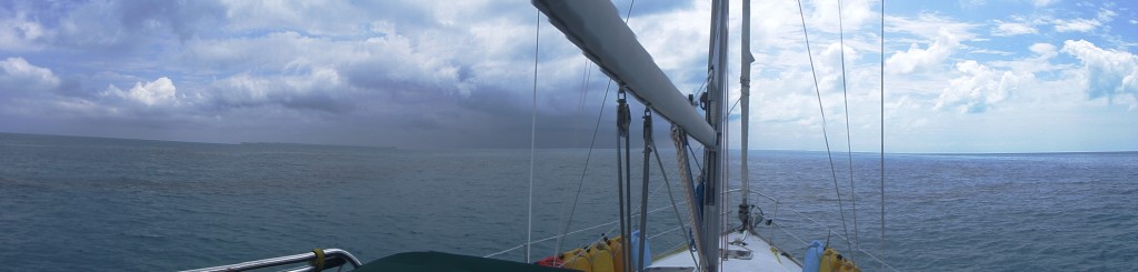
Driving Pearl into a storm on the Bahama Bank. Sails furled, hatches battened.
Crazy blue water. Things on the bottom 50 ft below were clearly visible.
North Rock light at the top of Bimini
I am soooo bored. My parent’s are no fun.
What do you mean I have to wear pants?
Yipee! I am toasty warm!!!
Storm done. Sun back out.
We picked what I thought was a great weather window. The predicted winds and swells were negligible. About a third of our way to our stop for the night at Mackey Shoals, we ran into a storm cell. We figured it would blow over, but instead it stayed with us until we got to Mackey Shoals. It quit just before we anchored for the night and gave us a spectacular sunset.